Showing posts with label Landmarks. Show all posts

Mt. Fuji

August 23, 2010 Leave a comment
Mt. Fuji Japan

Mount Fuji is the highest mountain in Japan at 3,776 m (12,388 ft).An active volcano that last erupted in 1707–08, it straddles the boundary of Shizuoka and Yamanashi prefectures just west of Tokyo, from which it can be seen on a clear day. It is located near the Pacific coast of central Honshū. Three small cities surround it: Gotemba (east), Fujiyoshida (north) and Fujinomiya (southwest).

Mount Fuji’s exceptionally symmetrical cone is a well-known symbol of Japan and it is frequently depicted in art and photographs, as well as visited by sightseers and climbers.

Mt. Fuji Summit
[Read More...]

Duino Castle, Duino

August 18, 2010 Leave a comment
Duino  Castle, Duino

Duino (Devin in Slovenian, Tybein in German) is a town in the coastal part of the municipality (comune) of Duino-Aurisina, part of the region of Friuli-Venezia Giulia in the province of Trieste, north-eastern Italy.

The total population is recorded as 8,753 (4,281 males, 4,472 females in 3,753 families), the population density (per square kilometre) as 193.8, and number of housing units as 3,983.

Duino is noted for being the place where the physicist Ludwig Boltzmann died and for inspiring the poet Rainer Maria Rilke to write his Duino Elegies.

Duino Castle, Duino

The two castles are the main attraction. The older castle, dating back to the eleventh century, is in ruins, while the newer castle is inhabited to this day and can be visited by tourists.

Below the ruins of the ancient castle there lies a white rock projecting into the sea, the Dama Bianca, which resembles a veiled woman and gave origin to many gothic legends.

The new castle of Duino is approximately dated to about the year 1400, when the family Wallsee commanded the construction of a strong fortress. Over time, the Wallsee family disappeared and the castle, after having been used as a prison, became the residence of the Luogar and Hofer. At the end of the 19th century it became the property of Prince Alexander Johann Vincenz Rudolf Hugo Karl Lamoral Eligius von Thurn und Taxis from the Czech Branch of the House of Thurn und Taxis. It remains with the family to this day with his great-grandson Prince Carlo Alessandro della Torre e Tasso, Duke of Castel Duino the current owner. The castle has been opened to the public as a museum and park.

Since 1982 the town has been home to the United World College of the Adriatic, a no-fee international school attended by students from 80 different countries.
[Read More...]

Italy's Grand Hotel Ritz

Leave a comment
Grand Hotel Ritz

The Grand Hotel Ritz, Italy, is situated in the fashionable Parioli district of Rome, near the new Auditorium concert venue, the Villa Glori park, the Euclide station with trains for the city centre and the Olympic Stadium. The area is full of trendy restaurants and boutiques. Public transportation that takes you to other parts of the city is also easy to reach. The property offers all the comforts necessary for a pleasant stay including two bars, a restaurant and conference facilities for up to 500 persons.


Grand Hotel Ritz Room Inside Grand Hotel Ritz
[Read More...]

Leaning Tower of Pisa, Italy

August 16, 2010 Leave a comment
The Leaning Tower of Pisa

This is the monument that, among the others of the "Piazza dei Miracoli", stirs the imagination of everybody, from the old to the young. Firstly we like to give you some information and events regarding its long history.

The Leaning Tower of Pisa

The construction of this imposing mass was started in the year 1174 by Bonanno Pisano. When the tower had reached its third storey the works ceased because it had started sinking into the ground. The tower remained thus for 90 years. It was completed by Giovanni di Simone, Tommano Simone (son of Andreo Pisano), crowned the tower with the belfry at half of 14th century.

The top of the Leaning Tower can be reached by mounting the 294 steps which rise in the form of a spiral on the inner side of the tower walls.

The Leaning Tower of Pisa Beside Duomo Cathedral

This very famous work is of Romanesque style, and as already stated dates back to the year 1174. Cylindrical in shape it is supplied whit six open galleries. A cornice separates these galleries one from the other and each presents a series of small arches fitted on the capitals of the slender columns. In the base there is a series of big blind arcades with geometrical decorations. In the belfry there is the same design of arcades as that of the base, with the difference that here, there are, apart from the reduced proportions, the housings of the bells.
[Read More...]

Castle of Rivoli

Leave a comment
The Castle of Rivoli

The Castle of Rivoli is a former Residence of the Royal House of Savoy in Rivoli (province of Turin, Italy). It is currently home to the Museum of Contemporary Art of Turin.

The Castle of Rivoli was probably built in the 9th-10th centuries, but its existence is mentioned for the first time only in 1159, in a diplom by Emperor Frederick Barbarossa that ceded the Rivolese territories to the bishops of Turin.

The House of Savoy acquired Rivoli in the 11th century, and soon began a feud with the bishops that as soon as 1184 provoked damage to the castle. In 1330 Amadeus VI of Savoy moved in the castle the Consiglio dei Principi, senior administrative council of the countryside. The castle was also the first place of public veneration of the Shroud of Turin in his path towards Turin under Amadeus IX.

The Castle of Rivoli

After a period of decline, the Treaty of Cateau-Cambrésis (1559) established that Duke Emmanuel Philibert could not reside in Turin until he had not a male child. He therefore set his residencei in the Castle of Rivoli, having it restored by architect Ascanio Vittozzi. In 1562 heir Charles Emmanuel I was born, and he returned to Turin. Works on Vittozzi’s designed were brought on until 1644 under Carlo and Amedeo di Castellamonte, with the construction of the so called Manica Lunga, intended to house the Savoy Gallery, the sole 17th century part of the edifice still visible today. Numerous of the works of art were however stolen by French troops in the following years. New works began after 1706.
[Read More...]

Times Square

August 14, 2010 Leave a comment
The Times Square

Times Square in New York City is formed by the intersection of Broadway, Seventh Ave., and 42d St. This famous square was named (1904) for the building there that formerly belonged to the New York Times. The building, located in the center of the square, is still famous for the outdoor news "zipper" that displays up-to-the-minute news. Times Square and the adjacent area form one of the most concentrated entertainment districts in the nation, featuring legitimate theaters, motion picture houses, shops, newsstands, bars, and restaurants. During the 1970s and 80s, the area became notorious for pornographic theaters and general tawdriness, but it was cleaned up and revived in the 1990s. Broadway at Times Square, jammed with traffic and illuminated by a profusion of enormous electrical signs, is known as the "Great White Way." On New Year’s Eve, close to a million people congregate there to celebrate.

The Times Square On A Poggy Day

There’s no doubting that Times Square has evolved into something much different than it was well over a decade ago, when it had a deservedly sleazy reputation. There is much debate among New Yorkers about which incarnation was better. For the natives, Times Square is a place we go out of our way to avoid. The crowds, even by New York standards, are stifling; the restaurants, mostly national chains, aren’t very good; the shops, also mostly national chains, are unimaginative; and the attractions, such as Madame Tussaud’s New York wax museum and Ripley’s Believe it or Not, are kitschy. I suppose it’s a little too Vegas for me. Still, you’ve come all this way; you’ve got to at least take a peek, if only for the amazing neon spectacle of it.

Most of the Broadway theaters are around Times Square, so plan your visit before or after the show you’re going to see. For your pretheater meal, walk 2 blocks west to Ninth Avenue where you’ll find a number of relatively inexpensive, good restaurants. If you are with the kids, the Ferris wheel in the Toys "R" Us store makes a visit to Times Square worthwhile.

Most people assume that Times Square is actually a square, but it’s not. It’s more of a triangle or a mere intersection of major streets. Broadway and 7th Avenue cross at 42nd street, creating the busiest area in New York City.


The Times Square The Times Square - The 7th Avenue
[Read More...]

The Metropolitan Museum of Art

Leave a comment
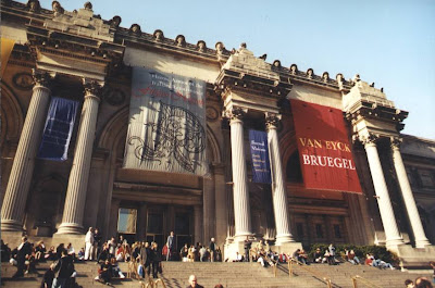
Metropolitan Museum of Art

The Metropolitan Museum of Art is an art museum located on the eastern edge of Central Park, along what is known as Museum Mile in New York City, USA. It has a permanent collection containing more than two million works of art, divided into nineteen curatorial departments. The main building, often referred to simply as "the Met," is one of the world’s largest art galleries, and has a much smaller second location in Upper Manhattan, at "The Cloisters," which features medieval art.

Represented in the permanent collection are works of art from classical antiquity and Ancient Egypt, paintings and sculptures from nearly all the European masters, and an extensive collection of American and modern art. The Met also maintains extensive holdings of African, Asian, Oceanic, Byzantine and Islamic art. The museum is also home to encyclopedic collections of musical instruments, costumes and accessories, and antique weapons and armor from around the world. A number of notable interiors, ranging from 1st century Rome through modern American design, are permanently installed in the Met’s galleries.

Metropolitan Museum of Art Great Hall

The Metropolitan Museum of Art was founded in 1870 by a group of American citizens. The founders included businessmen and financiers as well as leading artists and thinkers of the day who wanted to open a museum to bring art and art education to the American people. It opened on February 20, 1872, and was originally located at 681 Fifth Avenue. John Taylor Johnston, a railroad executive whose personal art collection seeded the museum, served as its first President, and the publisher George Palmer Putnam was its founding Superintendent. The artist Eastman Johnson acted as Co-Founder of the museum. In 1873, occasioned by the Met’s purchase of the Cesnola Collection of Cypriot antiquities, the museum took up temporary residence at the Douglas Mansion on West 14th Street; after negotiations with the City of New York, the Met acquired land on the east side of Central Park, where it built its permanent home, a red-brick Gothic Revival stone "mausoleum" designed by American architects Calvert Vaux and Jacob Wrey Mould. The building was designated a National Historic Landmark in 1986.

As of 2007, the Met measures almost a quarter mile long and occupies more than two million square feet, more than 20 times the size of the original 1880 building.
[Read More...]

Central Park in New York City

August 13, 2010 Leave a comment
New York City Central Park

Central Park is a large public, urban park (843 acres, 4.1 km × 830 m) in the borough of Manhattan in New York City, almost 4/5 of the size of Vancouver’s Stanley Park and just over 1/3 of the size of London’s Richmond Park. With about twenty-five million visitors annually, Central Park is the most visited city park in the United States, and its appearance in many movies and television shows has made it famous.

The park is maintained by the Central Park Conservancy, a private, not-for-profit organization that manages the park under a contract with the New York City Department of Parks and Recreation, in which the president of the Conservancy is ex officio Administrator of Central Park.

Central Park is bordered on the north by West 110th Street, on the south by West 59th Street, on the west by Eighth Avenue. Along the park’s borders however, these are known as Central Park North, Central Park South, and Central Park West respectively. Fifth Avenue retains its name along the eastern border of the park. Most of the areas immediately adjacent to the park are known for impressive buildings and valuable real estate.

New York City Central Park

The park was designed by landscape architect Frederick Law Olmsted and architect Calvert Vaux, who went on to collaborate on Brooklyn’s Prospect Park. Central Park has been a National Historic Landmark since 1963.

While much of the park looks natural, it is in fact almost entirely landscaped. It contains several natural-looking lakes and ponds, extensive walking tracks, two ice-skating rinks, the Central Park Zoo, the Central Park Conservatory Garden, a wildlife sanctuary, a large area of natural woods, a 106-acre (0.43 km2) billion gallon reservoir with an encircling running track, and an outdoor amphitheater called the Delacorte Theater which hosts the "Shakespeare in the Park" summer festivals. Indoor attractions include Belvedere Castle with its nature center, the Swedish Cottage Marionette Theatre, and the historic Carousel. In addition there are numerous major and minor grassy areas, some of which are used for informal or team sports, some are set aside as quiet areas, and there are a number of enclosed playgrounds for children.

New York City Central Park

The park has its own wildlife and also serves as an oasis for migrating birds, especially in the fall and the spring, making it a significant attraction for bird watchers; 200 species of birds are regularly seen. Of particular interest to New Yorkers has been the resident hawk population, especially Pale Male, a Red-tailed Hawk who has been mentioned in a Steve Earle song and on Late Night with Conan O’Brien. When Olmstead designed the park, he does not seem to have made provision for predators, perhaps because his view of nature was not based on an ecological understanding. Pale Male and several other hawks simply appeared, overcame opposition from other birds and humans, and filled a long-vacant ecological niche.

The 6 miles (10 km) of drives within the park are used by joggers, bicyclists and inline skaters, especially on weekends, and in the evenings after 7:00 p.m., when automobile traffic is banned.
[Read More...]

Empire State Building

Leave a comment
The Empire State Building

The Empire State Building is a 102-story Art Deco skyscraper in New York City at the intersection of Fifth Avenue and West 34th Street. Its name is derived from the nickname for the state of New York. It stood as the world’s tallest building for more than forty years, from its completion in 1931 until construction of the World Trade Center’s North Tower was completed in 1972. Following the destruction of the World Trade Center in 2001, the Empire State Building again became the tallest building in New York City and New York State.

The Empire State Building

The Empire State Building has been named by the American Society of Civil Engineers as one of the Seven Wonders of the Modern World. The building and its street floor interior are designated landmarks of the New York City Landmarks Preservation Commission, and confirmed by the New York City Board of Estimate. It was designated as a National Historic Landmark in 1986. In 2007, it was ranked number one on the List of America’s Favorite Architecture according to the AIA. The building is owned and managed by W&H Properties.
[Read More...]

The National September 11 Memorial & Museum

July 30, 2010 Leave a comment
The National September 11 Memorial & Museum or formerly the World Trade Center Memorial Foundation, Inc., was formed as a 501(c)(3) non-profit corporation to raise funds and manage the planning and construction of the memorial. Its board of directors had its inaugural meeting on January 4, 2005. The National September 11 Memorial & Museum reached its first phase capital fundraising goal of US$350 million in April 2008. This money, along with additional amounts raised, will be used to build the Memorial & Museum and to create an endowment for the museum.

Public Domain: World Trade Center Memorial by Denise Gould (DOD Photo 060911-F-9471G-006) by pingnews.com.

The National September 11 Memorial Museum will be located 70 feet below ground. An admission fee is under consideration. The museum will feature interactive exhibits that are designed to teach visitors about the terrorist attacks of September 11, 2001 and February 26, 1993 through firsthand accounts and artifacts. The largest asset of the museum will be the exposed slurry wall, which held back the Hudson River and remained standing after the attacks.

The Memorial Mission:
  • Remember and honor the thousands of innocent men, women, and children murdered by terrorists in the horrific attacks of February 26, 1993 and September 11, 2001.
  • Respect this place made sacred through tragic loss.
  • Recognize the endurance of those who survived, the courage of those who risked their lives to save others, and the compassion of all who supported us in our darkest hours.
  • May the lives remembered, the deeds recognized, and the spirit reawakened be eternal beacons, which reaffirm respect for life, strengthen our resolve to preserve freedom, and inspire an end to hatred, ignorance and intolerance.
The memorial consists of a park at street level with two recessed square pools located 30 feet (9m) below street level, fed by waterfalls along the walls. At the center of the pools are recessed squares into which the water flows. The waterfalls will be the largest manmade waterfalls in the country.


The names of the victims will be inscribed on parapets surrounding the pools at street level. The design will place the names of the victims who were in Tower 1 and the victims on Flight 11 (which hit Tower 1) around the North Pool. The names surrounding the South Pool will include: those killed in Tower 2, the victims who were in the immediate vicinity of the Towers, the victims on Flight 175 (which hit Tower 2), the first responders, the passengers on Flight 93, which crashed near Shanksville, Pennsylvania, the passengers on Flight 77, which hit The Pentagon; those killed at The Pentagon, and the victims of the 1993 World Trade Center bombing. Company employees and their visitors will be listed together, but without the names of their companies. Passengers of the four flights will be listed together under their flight numbers. First responders will be listed together with their units.

The Sphere, the Fritz Koenig-designed sculpture that formerly stood in the outdoor plaza between the towers, will be returned to its original location. It is currently located in Battery Park, serving as a temporary memorial.
[Read More...]

The Statue of Liberty

April 20, 2010 Leave a comment
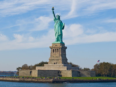
The Statue of Liberty (French: Statue de la Liberté), officially titled Liberty Enlightening the World (French: la Liberté éclairant le monde), dedicated on October 28, 1886, is a monument commemorating the centennial of the signing of the United States Declaration of Independence, given to the United States by the people of France to represent the friendship between the two countries established during the American Revolution. It represents a woman wearing a stola, a radiant crown and sandals, trampling a broken chain, carrying a torch in her raised right hand and a tabula ansata, where the date of the Declaration of Independence JULY IV MDCCLXXVI is inscribed, in her left arm. Standing on Liberty Island in New York Harbor, it welcomes visitors, immigrants, and returning Americans traveling by ship. Frédéric Auguste Bartholdi sculpted the statue and obtained a U.S. patent for its structure. Maurice Koechlin-chief engineer of Gustave Eiffel's engineering company and designer of the Eiffel Tower-engineered the internal structure. The pedestal was designed by architect Richard Morris Hunt. Eugène Viollet-le-Duc was responsible for the choice of copper in the statue's construction, and for the adoption of the repoussé technique, where a malleable metal is hammered on the reverse side.

Statue of Liberty

The statue is made of a sheathing of pure copper, hung on a framework of steel (originally puddled iron) with the exception of the flame of the torch, which is coated in gold leaf (originally made of copper and later altered to hold glass panes). It stands atop a rectangular stonework pedestal with a foundation in the shape of an irregular eleven-pointed star. The statue is 151 ft (46 m) tall, but with the pedestal and foundation, it is 305 ft (93 m) tall.

Worldwide, the Statue of Liberty is one of the most recognizable icons of the United States. and was, from 1886 until the Jet Age, often one of the first glimpses of the United States for millions of immigrants after ocean voyages from Europe.

The statue is the central part of Statue of Liberty National Monument, administered by the National Park Service. The National Monument also includes Ellis Island.

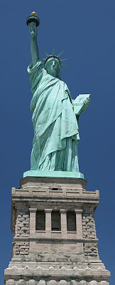
The classical appearance (Roman stola, sandals, facial expression) derives from Libertas, ancient Rome's goddess of freedom from slavery, oppression, and tyranny. Her raised right foot is on the move. This symbol of Liberty and Freedom is not standing still or at attention in the harbor, it is moving forward, as her left foot tramples broken shackles at her feet, in symbolism of the United States' wish to be free from oppression and tyranny. Since the 1940s, it has been claimed that the seven spikes or diadem atop of the crown epitomize the Seven Seas and seven continents. Her torch signifies enlightenment. The Keystone in her hand represents knowledge and shows the date of the United States Declaration of Independence, in Roman numerals, July IV, MDCCLXXVI.

Statue of Liberty Frontal View

The general appearance of the statue’s head approximates the Greek Sun-god Apollo or the Roman Sun-god Helios as preserved on an ancient marble tablet (today in the Archaeological Museum of Corinth, Corinth, Greece)-Apollo was represented as a solar deity, dressed in a similar robe and having on its head a "radiate crown" with the seven spiked rays of the Helios-Apollo's sun rays, like the Statue's nimbus or halo. The ancient Colossus of Rhodes, one of the Seven Wonders of the Ancient World, was a statue of Helios with a radiate crown. The Colossus is referred to in the 1883 sonnet The New Colossus by Emma Lazarus. Lazarus's poem was later engraved on a bronze plaque and mounted inside the Statue of Liberty in 1903.

To different observers, the statue has reminded of the values that the United States seemingly does or should possess. For example, documentarian Ken Burns recounts how the statue became a symbol of "America's open-door policy." In his book, Man's Search for Meaning, the existential therapist Viktor Frankl recommended "that the Statue of Liberty on the East Coast should be supplemented by a Statue of Responsibility on the West Coast."

The Statue of Liberty quickly became a popular icon, featured in scores of posters, pictures, motion pictures, and books. A 1911 O. Henry story relates a fanciful conversation between "Mrs. Liberty" and another statue; it figured in 1918 Liberty Loan posters. During the 1940s and 1950s, pulp Science Fiction magazines featured Lady Liberty surrounded by ruins or by the sediments of the ages. It has been in dozens of motion pictures. It is a setting in the 1942 Alfred Hitchcock movie Saboteur, which featured a climactic confrontation at the statue. Half submerged in the sand, the Statue provided the apocalyptic revelation at the end of 1968's Planet of the Apes. The statue walked from Liberty Island to Manhattan in the 1989 film, Ghostbusters II, to defeat the villain with positive energy when it inspired hope amongst cheering New Yorkers. It was the setting for the climax of the first X-Men film. It can also be seen lying broken on the ground in the movie Independence Day, after the first wave of attacks by extraterrestrials. In the 2004 movie The Day After Tomorrow, the statue gets frozen, and in the 2008 movie Cloverfield, it is decapitated by a giant monster; its head lands in a Manhattan street. In the 1994 Gundam series G Gundam, the protagonist hides his Gundam in the abandoned statue and then makes it jump out of the statue, destroying it. In the film, National Treasure: Book of Secrets, the sister statue in Paris provides a clue. The history of the Statue of Liberty is retold in the hit 2008 illustrated book Lady Liberty: A Biography.

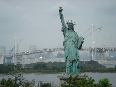
Statue of Liberty Model in Tokyo

It was the subject of a 1978 -University of WisconsinMadison prank in which Lady Liberty appeared to be standing submerged in a frozen-over local lake. It has appeared on New York and New Jersey license plates, is used as a logo for the NHL's New York Rangers and the WNBA's New York Liberty, and it was the subject of magician David Copperfield's largest vanishing act.

In 1982 Jessica Skinner was born inside the statue. Her mother went into labor while climbing the stairs, and gave birth before she could get back to ground level.

In Men in Black II, an emergency neuralizer is built into the Statue of Liberty to erase everyone's memories in case of a mass display.

It also starred in the video game Grand Theft Auto IV, in which it's called "The Statue of Happiness", since the statue is smiling in the game. It also holds up a cup of coffee instead of a torch.
[Read More...]

The Niagara Falls

March 5, 2010 1 comments
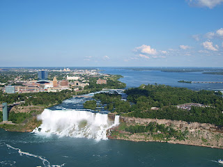
The Niagara Falls are voluminous waterfalls on the Niagara River, straddling the international border between the Canadian province of Ontario and the U.S. state of New York. The falls are 17 miles (27 km) north-northwest of Buffalo, New York and 75 miles (120 km) south-southeast of Toronto, Ontario, between the twin cities of Niagara Falls, Ontario, and Niagara Falls, New York. Niagara Falls is composed of two major sections separated by Goat Island: Horseshoe Falls, the majority of which lies on the Canadian side of the border, and American Falls on the American side. The smaller Bridal Veil Falls are also located on the American side, separated from the main falls by Luna Island.

Niagara Falls were formed when glaciers receded at the end of the Wisconsin glaciation (the last ice age), and water from the newly formed Great Lakes carved a path through the Niagara Escarpment en route to the Atlantic Ocean. While not exceptionally high, the Niagara Falls are very wide. More than 6 million cubic feet (168,000 m³) of water falls over the crest line every minute in high flow, and almost 4 million cubic feet (110,000 m³) on average. It is the most powerful waterfall in North America. The Niagara Falls are renowned both for their beauty and as a valuable source of hydroelectric power. Managing the balance between recreational, commercial, and industrial uses has been a challenge for the stewards of the falls since the 1800s. Niagara Falls is divided into the Horseshoe Falls and the American Falls. The Horseshoe Falls drop about 173 feet (53 m), the height of the American Falls varies between 70-100 feet (21-30 m) because of the presence of giant boulders at its base. The larger Horseshoe Falls are about 2,600 feet (790 m) wide, while the American Falls are 1,060 feet (320 m) wide.

Niagara Falls

The volume of water approaching the falls during peak flow season may sometimes be as much as 202,000 cubic feet (5,700 m3) per second. Since the flow is a direct function of the Lake Erie water elevation, it typically peaks in late spring or early summer. During the summer months, 100,000 cubic feet (2,800 m3) per second of water actually traverses the Falls, some 90% of which goes over the Horseshoe Falls, while the balance is diverted to hydroelectric facilities. This is accomplished by employing a weir with movable gates upstream from the Horseshoe Falls. The Falls flow is further halved at night, and during the low tourist season in the winter, remains a flat 50,000 cubic feet (1,400 m3) per second. Water diversion is regulated by the 1950 Niagara Treaty and is administered by the International Niagara Board of Control (IJC). Viewpoints on the American shore generally are astride or behind the falls. The falls face directly toward the Canadian shore.

Peak numbers of visitors occur in the summertime, when Niagara Falls are both a daytime and evening attraction. From the Canadian side, floodlights illuminate both sides of the Falls for several hours after dark (until midnight). The number of visitors in 2008 is expected to total 20 million and by 2009, the annual rate is expected to top 28 million tourists a year. The oldest and best known tourist attraction at Niagara Falls is the Maid of the Mist boat cruise, named for an ancient Ongiara Indian mythical character, which has carried passengers into the rapids immediately below the Falls since 1846. Cruise boats operate from boat docks on both sides of the falls.

Niagara Falls - American Bridal Falls

From the U.S. side, the American Falls can be viewed from walkways along Prospect Point Park, which also features the Prospect Point Park observation tower and a boat dock for the Maid of the Mist. Goat Island offers more views of the falls and is accessible by foot and automobile traffic by bridge above the American Falls. From Goat Island, the Cave of the Winds is accessible by elevator and leads hikers to a point beneath Bridal Veil Falls. Also on Goat Island are the Three Sisters Islands, the Power Portal where a huge statue of Nikola Tesla can be seen, and a walking path which enables views of the rapids, the Niagara River, the gorge, and all of the Falls. Most of these attractions lie within the Niagara Falls State Park. The Niagara Scenic Trolley offers guided trips along the American Falls and around Goat Island. Panoramic and aerial views of the falls can also be viewed from the Flight of Angels helium balloon ride, or by helicopter. The Niagara Gorge Discovery Center showcases the natural and local history of Niagara Falls and the Niagara Gorge. A casino and luxury hotel was opened in Niagara Falls, New York, by the Seneca Indian tribe. The Seneca Niagara Casino occupies the former Niagara Falls Convention Center. The new hotel is the first addition to the city's skyline since completion of the United Office Building in the twenties.

Niagara Falls - Canadian Horseshoe Falls

On the Canadian side, Queen Victoria Park features manicured gardens, platforms offering spectacular views of both the American and Horseshoe Falls, and underground walkways leading into observation rooms which yield the illusion of being within the falling waters. The observation deck of the nearby Skylon Tower offers the highest overhead view of the Falls, and in the opposite direction gives views as far as distant Toronto. Along with the Minolta Tower (formerly the Seagrams Tower, currently the Konica Minolta Tower), it is one of two towers in Canada with a view of the Falls. Along the Niagara River, the Niagara River Recreational Trail runs the 35 miles (56 km) from Fort Erie to Fort George, and includes many historical sites from the War of 1812. The Whirlpool Aero Car, built in 1916 from a design by Spanish engineer Leonardo Torres y Quevedo, is a cable car which takes passengers over the whirlpool on the Canadian side. The Journey Behind the Falls - accessible by elevators from the street level entrance - consists of an observation platform and series of tunnels near the bottom of the Horseshoe Falls on the Canadian side. There are two casinos on the Canadian side of Niagara Falls, the Niagara Fallsview Casino Resort and Casino Niagara. The former is situated in the Fallsview Tourist Area, alongside many of the area's hotels, whilst the latter is adjacent to Clifton Hill, on Falls Avenue, a major tourist promenade.
[Read More...]

The Grand Palace of Bangkok

February 14, 2010 Leave a comment
The Grand Palace or the Phra Borom Maha Ratcha Wang (พระบรมมหาราชวัง) in Thai is a complex of buildings in Bangkok, Thailand. It served as the official residence of the Kings of Thailand from the 18th century onwards. Construction of the Palace began in 1782, during the reign of King Rama I, when he moved the capital across the river from Thonburi to Bangkok. The Palace has been constantly expanded and many additional structures were added over time. The present King of Thailand, King Bhumibol Adulyadej, however, resides at the Chitralada Palace.

The history of the palace started when King Buddha Yodfa Chulaloke (Rama I) decided to move the capital of Siam from Thonburi on the west to Bangkok on the east of the Chao Phraya River he decided to build a magnificent new palace as a place of residence as well as a centre of government. The area chosen was however occupied by Chinese merchants, who he promptly asked to relocate (to the present day Yaowarat area).

The Grand Palace of Bangkok

The tower of gold began construction on 6 May 1782. At first the palace consisted of several wooden buildings surrounded on four sides with a high defensive wall of 1,900 metres in length, which encloses an area of 218,400 square metres. Soon the King ordered the building of the Temple of the Emerald Buddha; as the Monarch’s personal place of worship and royal temple. Once the palace was complete the King decided to under go a coronation ceremony to celebrate in 1785.

The plan of the Grand Palace followed closely that of the old palace in Ayutthaya. The Palace is rectangular shaped, with the western side next to a river and the royal temple situated to the east side, with all structures facing north. The palace itself is divided into three quarters: the outer quarters, the middle quarters and the inner quarters.

The palace became the centre of the Rattanakosin government and royal court for most of the early Chakri Dynasty until the reign of King Chulalongkorn (Rama V) who preferred to stay at the Dusit Palace, but still used the Grand Palace as an office and primary place of residence. This practice was followed by his sons (Rama VI and Rama VII) who preferred their own palaces. King Ananda Mahidol (Rama VIII) moved into the palace full time after his return from abroad in 1945. However after his mysterious death a year later in one of the palaces inside the complex, his brother King Bhumibol Adulyadej (Rama IX) who succeeded him decided to move permanently to the Chitralada Palace.

The Grand Palace of Bangkok from the River

The Palace is however still very much in use; as many royal rituals are performed here by the King every year. Other royal ceremonies celebrated here are coronations; royal funerals, marriages and state banquets. The Palace grounds also contain the offices and buildings of the Bureau of the Royal Household, the Office of the Private Secretary to the King and Royal Institute of Thailand.
[Read More...]

Going to Mt. Fuji

August 4, 2009 Leave a comment

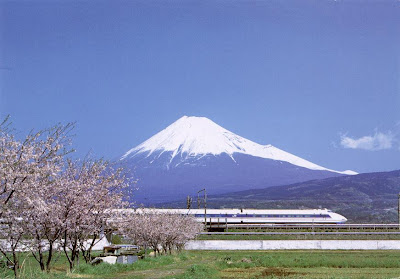
Mount Fuji (富士山 Fuji-san, 3776 meters) is Japan's highest mountain and the focal point of the sprawling Fuji-Hakone-Izu National Park. Visible from Tokyo on a clear day, the mountain is located to the west of Tokyo on the main island Honshu.

A perfectly symmetrical volcanic cone, the mountain is a near-mythical national symbol immortalized in countless works of art, including Hokusai's 36 Views of Mt. Fuji.

The Japanese always refer to Mt. Fuji as Fuji-san, but the -san (山) here simply means "mountain", and has nothing to do with the honorific san (さん) for people's names. "Fujiyama" is a misreading of the name, and is never used by the Japanese themselves — except in the set phrase Fujiyama geisha, a lament at how Japan is misunderstood in the West.

The official climbing season lasts for only two months, from July to August. Even during these months, when Tokyo often swelters in 40°C heat, temperatures at the top can be below freezing at night and climbers must dress adequately.

Climbing outside the official season is extremely dangerous without alpine climbing experience and equipment. Nearly all facilities are closed in the off season. The weather, unpredictable any time of year, is downright vicious in the winter (temperatures below -40°C have been reported up top) and there are cases of people being literally blown off the mountain by high winds. All roads to the 5th station are shut out of season so you will have a long walk up. But if you insist, you're strongly encouraged to at least file a climbing plan with the Yoshida police (Japanese only).

Mount Fuji

Fortunately, there are a few options for those who are not fit enough to climb or who would like to get "up close" to the mountain in the off-season. The trails at the bottom of the mountain are less steep, and suited more for an afternoon hike at any time of the year. The nearby Fuji Five Lakes (Fuji-goko) has many attractions close to the mountain, and Hakone also provides spectacular views.

Mt. Fuji can be approached from all sides, but note that transport schedules are sharply cut outside the official climbing season in July and August. For up to date information, the city of Fujiyoshida maintains a Fuji access page listing current routes and schedules.

From Tokyo, the easiest and most popular option is to take a direct bus from Shinjuku to the trailhead at Kawaguchiko Fifth Station. The most economical approach is by Odakyu train from Shinjuku to Gotemba, although you will have to change trains and the price difference is rather minimal.

Mt. Fuji Shizuoka Airport near Shizuoka opened in June 2009. Despite the name, it's over 80 km away to the west of the mountain and not much closer to Mt. Fuji than Tokyo's airports.

Mount Fuji Map

The easiest option for reaching the slopes of Mt. Fuji is to take the Keio express bus from Shinjuku in Tokyo. The direct bus takes 2 to 2.5 hours, depending on traffic, costs ¥2600, and takes you directly to the start of the climb at Kawaguchiko 5th Station. To buy a ticket, take the west exit at Shinjuku station, then follow the circle of bus stops to the left. The Keio building is on the corner near stop 26, right across from Yodobashi Camera.

There is no direct access to Mt. Fuji by train, but you can get pretty close and change to a bus for the rest of the way, and doing it this way allows you to use any of the ascent or descent routes. From Tokyo, the two main staging points are Fujiyoshida and Gotemba, while visitors from western Japan can opt for Fujinomiya (Shin-Fuji) instead.

Fujiyoshida can be reached by taking the JR Chuo line to Otsuki and changing to the Fujikyu line. The Fujikyu line passes through Fujiyoshida to Kawaguchiko, from where hourly buses (50 minutes, ¥1700) shuttle to the 5th Station. If you are planning to walk from the foot of the mountain, Fujiyoshida is, also, the starting point of the Yoshida route. You will be able to visit Fujiyoshida Sengenjinja (shrine) on the way to the summit.

If heading for the Gotemba route (御殿場), Subashiri route, or Suyama route, take the JR Tokaido line from Tokyo through Odawara to Kōzu (府津) station then change train for Gotemba. Alternatively, if traveling from Shinjuku, take the Odakyu line to Shin-Matsuda and walk to the neighboring Gotemba line Matsuda station. This local train usually runs just once per hour.
Going to Mt. Fuji

During official climbing season there are direct buses from the Gotemba station to the Gotemba 5th station that take about 40 minutes and cost ¥1080/1500 one-way/return. Tickets to the Subashiri 5th station are ¥1500/2000 one-way/return. A bus for the Suyama route is ¥530 one-way. If you want to ascend and descend on different routes, you can purchase a 3-day round trip ticket for a little over ¥3000. Note that Gotemba buses run only during the official Fujisan mountain climbing season between July and August, but Subashiri route busses run till October and Suyama route busses run all year around.

There is also a bus to Kawaguchiko from the Gotemba station and a bus from Shin-Matsuda to the Kawaguchiko fifth station (¥3000 one-way).

Visitors coming from western Japan may wish to opt for the southern approach via Fujinomiya (富士宮) instead. The nearest Tokaido Shinkansen stop is Shin-Fuji station (新富士駅). From Shin-Fuji station, buses cost ¥4500 return. If arriving on the ordinary Tokaido line, change trains to the JR Minobu Line at Fuji station. The bus fare from Fujinomiya station to the 5th station of Mt. Fuji is 1,970 for one-way or 3,000 for round-trip.

By car take the Chuo Expressway from Shinjuku. Tolls will set you back around ¥2500.

There are also Fuji-san climbing tours offered by numerous travel companies throughout Japan. These tours may include round trip bus fare, climbing guide, hut, dinner, breakfast (packed rice box), and a visit to a hot spring after the descent. Prices tend to be expensive though: a one-day "superman" tour costs around ¥20000 and a more leisurely two-day approach (including overnight stay) is over ¥30000. Most of these tours are conducted in Japanese and stick firmly to the trodden path, but if you need an English-speaking guide to accompany you to the top or want to explore the less-well known "pilgrimage" routes, Fuji Mountain Guides offers small group ascents from US$249 for a two-day trip, including lodging.

Source: WikiTravel

[Read More...]

Chaweng Beach of Koh Samui

February 10, 2009 Leave a comment

Over the past twenty years, Chaweng Beach has been transformed from a near deserted tropical bay, inhabited by a handful of fishermen and visited by a few adventurous backpackers, into a vibrant, busy, cosmopolitan resort town. Over the past twenty years, Chaweng Beach has been transformed from a near deserted tropical bay, inhabited by a handful of fishermen and visited by a few adventurous backpackers, into a vibrant, busy, cosmopolitan resort town.

This is undoubtedly the most popular tourist area on Koh Samui, and with its 5-kilometer white-sand beach, water sports, entertainment venues and shopping facilities, as well as a fabulous range of dining options, it is easy to see the attraction.

Chaweng Beach of Koh Samui

Chaweng's development has naturally centred on the beach, the main road runs parallel to it, and the beach itself is lined with resorts and hotels along its entire length. At the northern and southern ends there is a calmer, more family orientated atmosphere, whilst around the central nightlife zone near the famous Soi Green Mango, budget beach resorts attract a younger crowd.

The seedier side of Thai tourism is in evidence but not dominant in Chaweng, and can be easily avoided. The overall atmosphere will appeal to anyone who likes people watching, and to those who enjoy staying where every service and amenity is conveniently close to hand.

Chaweng beach road is lined with shops, restaurants and bars of every size and description. International chains such as Starbucks, and Burger King sit alongside rickety canvas-covered market stalls.

Long stretches of the main road are occupied by small local business selling many different souvenirs, handicrafts while money changing booths and ATMS, internet cafes, laundry services, travel agents, car and motorbike rentals and international-style pharmacies fill the spaces in between.

Over the years, Chaweng Beach has developed at an incredible pace and because of this the infrastructure does not always keep up with demand. The beach road suffers from inadequate drainage in the monsoon season, as well as traffic congestion, although a recently instigated one-way system has reduced traffic jams. This one-way system also takes tourists through some of the more "Thai" areas off the main beach road, which could be of interest to more adventurous souls.

Chaweng Laem Din Market

The Thai market area of Laem Din is located directly behind the main tourist strip with a covered fresh produce market, as well as local cooked delicacies, and bargain clothes. These backstreets are also where many Thai people that work in Chaweng live.

On the Beach road, the streets can seem deserted during the hottest hours of the day, when the tourists are all on the beach, so most business is conducted after 5pm, when the hustle and bustle begins, with people cruising for pre-dinner drinks, souvenir shopping at the little street-side stalls, and choosing where to dine.

The scene as the sun goes down is a colorful, noisy melting pot of pedestrians strolling the sidewalks, with motorbikes, taxis crawling along the road n search of a fare. While down in the clubbing zone, the vibrant atmosphere continues way into the night and the crowds don't disperse until the sun comes up.

Chaweng Busy Road

There are also two hospitals in the area that provide international standard services. The Samui International Hospital is located at the far northern end of the beach road and has a drop-in clinic for minor illnesses, and a good dentist.

The Bangkok Samui Hospital is a little further from the beach on the island's ring road and offers very sophisticated facilities.

[Read More...]